Reef Trust Forum Videos – December 2020
The Mary River catchment is the fourth highest contributor of fine sediment to the Great Barrier Reef. The Australian Government Reef Trust program is focused on streambank protection in the Mary River catchment, as streambank erosion is known to contribute the greatest majority of sediment out of the catchment to the Great Barrier reef.
The Mary River Catchment Coordinating Committee works closely with landholders to reduce the amount of sediment entering the Great Barrier Reef by prioritising sites and performing small to large scale works.
Four videos were produced for the Reef Forum, which was an online event as a result of the Covid pandemic. Click on the link to hear First Nations people talk about caring for country in the Mary River Catchment.
The following three part short video series expands upon each bank stabilisation method used within the Mary River catchment
Part 1: Vine weed control to protect existing vegetation
Part 2: Revegetation of degraded streambanks
Part 3: Mitigating severe riverbank erosion
The Mary River Catchment Coordinating Committee acknowledges the First Nations Peoples of the Mary River Catchment.
We pay our respects to all Elders, past, present and emerging.
Reef Trust Phase IV – Riparian revegetation & rehabilitation in the Mary River Catchment –
The Australian Government’s Reef Trust Phase IV is focused on riparian revegetation activities in priority catchments of the Great Barrier Reef which includes the Mary River catchment.
The MRCCC Reef Trust phase IV project is now in its fourth year targeting riverbank restoration. The project began in mid-2017 and continues until mid-2022. The aim of the project is to remediate streambank erosion in key river reaches and tributaries of the catchment that are contributing high sediment loads. The target reaches are:
- Kenilworth (Walli Creek to Moy Pocket) – Mary River
- Mary Valley (Tuchekoi – Traveston Crossing) – Mary River
- Miva – Mary River
- Mid-Amamoor Creek
- Mid Kandanga Creek
Through the MRCCC’s Reef Trust phase IV project, modest incentive grants for landholders are provided to undertake activities including riparian fencing and installation of off-stream watering systems, riparian revegetation and control of weeds such as cat’s claw creeper and Chinese elm. The 2019/20 financial year saw a significant amount of project work planned and completed, with more revegetation and weed control planned for the 2020/21 financial year.
Encouragingly, over 50% of Reef Trust phase IV project participants are first-timers to MRCCC on-ground projects. Word of mouth has been a major factor in engaging new project participants, especially the connections between landholders on neighbouring properties.
There has also been collaboration with organisations such as HQPlantations, who manage a vast amount of land in the headwaters of key Mary Valley subcatchments – Amamoor and Kandanga Creeks. This partnership has the potential for the development of a coordinated approach to weed control. Another key engagement opportunity has been the railway corridor managed by the Mary Valley Rattler which travels through Amamoor and other Mary Valley subcatchments. As a community organisation, the Rattler is active in communication with landholders along the railway corridor, and engaging with them has allowed us to connect with these landholders. In the Miva reach of the Mary River the MRCCC has partnered with Maryborough Sugar Factory and the Maryborough Canegrowers Association to increase project awareness.
Mary Valley
|
A stand-out Reef Trust phase IV project was completed at Traveston Crossing in July 2020. At this site, located at the Research Facility managed by the Department of Agriculture and Fisheries, approximately 6750 plants were planted on 2.7 ha of river bank. DAF is keen to use the property as a showcase for best practice riparian management, and its location directly adjacent to the public river access point at Traveston Crossing makes it an excellent public demonstration site. This site links with the additional 12 landholders that are all rehabilitating their section of the riverbank in this reach from the confluence of Kandanga Creek to Traveston Crossing bridge.
Future Mary Valley Reef Trust phase IV projects currently in the planning stage will add a further 12 troughs, 1.2 km of fencing, 3.3 ha of weed control, and 4 ha of revegetation resulting in an additional 10,250 trees being planted. According to sediment modelling calculations developed by the CSIRO, the projects at the 34 Mary Valley properties will save a total of approximately 11,000 tonnes of streambank sediment that would otherwise cause sedimentation issues in Great Sandy Strait and southern Great Barrier Reef.
Biocontrol releases, particularly in the Amamoor Creek catchment area, will assist to control cat’s claw creeper infestations after physical control is completed. The table below shows the number and type of biocontrol released between July 2017 and July 2020.
| Biocontrol releases in the Mary Valley | |||
| Reach |
No. of jewel beetles |
No. of tingids | No. of madeira beetles |
| Amamoor Creek |
19,100 |
3,800 | 1,100 |
| Kandanga Creek | 8,130 | 670 |
200 |
| Mary Valley | 14,410 | 3,040 |
0 |
Kenilworth
Over the past 12 months a series of large scale revegetation projects were completed in the Kenilworth reach of the Mary River involving 12 properties. In 2019, the Carter riverbank stabilisation project was completed and revegetation was established. Those seedlings are now 1.5 metres tall and flowering.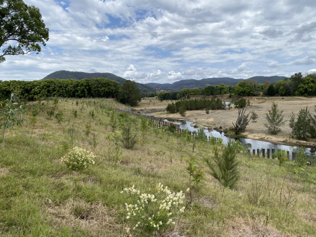
In August 2020, the Sample family Mary riverbank restoration project in the Kenilworth township was completed. The Reef Trust IV phase project will contribute fencing and revegetation to this large scale riverbank restoration project of approximately 16,000 trees to ensure long-term stability. This project will contribute to continuous riparian rehabilitation for 2.1 km along the left bank and 2.5 km along the right bank downstream from Kenilworth township.
Miva
In the Miva reach of the Mary River the MRCCC has engaged with cane growers and the Maryborough Sugar Factory to revegetate over 15.4 Ha of the riverbank in this district.
Queensland Government, Natural Resource Investment Program – Improving reef water quality in grazing lands 2020-2022
This project has on-ground project incentive funding available to grazing landholders.This new project will continue working with graziers on grazing land management activities that commenced in 2010 with Reef Rescue.
At present we are working with 7 grazing landholders to implement on-ground projects.
On-ground projects suitable for funding are installing tanks and troughs high in the landscape to create new cattle camps away from creeks, drainage lines etc; riparian fencing to manage stock access to the creeks; fencing for sensitive areas e.g. to allow gullied areas to recover etc.
- There are three target areas for this project:
- Munna Creek sub-catchment (including Teebar Creek)
- Noosa hinterland subcatchments (working in partnership with Country Noosa)
- Eel Creek sub-catchment (west of Gympie, including Pie, Marys, Jerry Creeks)
Field-days to showcase properties of project participants and grazing land management workshops are planned in each of these target sub-catchments over the next 2 years.
Gully Erosion Control Project – Great Barrier Reef Foundation (2019-2021)
The MRCCC Great Barrier Reef Foundation funded Gully Erosion Control project commenced in June 2019, following the finalisation of the Reef Trust funded gully erosion project in 2018.
Since the commencement of this new gully erosion control project in mid 2019 there have been 35 properties participate with over 48 gullies remediated to date or with plans to be remediated by 2021.
It is calculated that approximately 750 tonnes of fine sediment per year has been saved through these gully remediation works to date.
To broadly identify where priority should be focused for gully erosion control, landscapes dominated by sodic subsoils are targeted. In the Mary River catchment the CSIRO Atlas of Australian Soils Landscape units Tb69 and Tb70 provide a strong indication of gully erosion. With this information, areas of likely gully erosion are targeted for project works. Districts such as Curra, Glen Echo, Gundiah, Miva, Sexton, Teebar, Tiaro and Yerra, contain large areas of these landscape units and are target areas for this gully erosion project.
Types of on-ground gully erosion control projects
The on-ground projects (on 35 properties) involved fencing of the gullied area to manage stock access to the fragile erosion area and to allow natural recovery of pasture, groundcover and vegetation. Many of the projects also involved the provision of alternate stock water supplies by establishing new cattle camps higher in the landscape away from gullies and drainage lines through the installation of new tanks / troughs.
During the dry season of 2020 (May to September) a series of larger scale gully erosion project sites were completed using a variety of construction methods. At Sexton, 3 large gullies were repaired using the following methods:
- Meshed rock chute
- Geofabric drop structure
- Grassed chute and re-instatement of the original channel.
At Tiaro two gullies were remediated using a rock chute on the Mary River and a grassed loam chute with a diversion bank. At St Marys, a very large, 12 metre deep gully was remediated using a rock chute to prevent further advancement. This gully flows directly into the Mary River. At Home Park a meshed rock chute and geofabric chute on Netherby Creek was constructed.
At Lower Wonga, a series of gully heads were remediated using grassed chutes, diversion banks, sills and a detention pond. This site linked with a successful 30 year old National Soil Conservation Program (NSCP) gully erosion demonstration site. At Miva two gullies were remediated using a gravel blanket technique to slow flows through the site. Following earthworks at these sites they were seeded with Rhodes grass and planted with Pangola runners. John Day assisted the MRCCC with design work and supervision of the construction work.
Rock chutes were constructed in early 2020 at Gundiah and Kenilworth. The Kenilworth gully formed in a drainage line adjacent to the Mary River following the February flood.
Plans are currently being prepared for remediation of sites at Glen Echo, Teebar, Curra and Gundiah.
Caitlin Mill, Katie Johnston and Bec Watson delivered a series of 1-on-1 training days with interested landholders on the construction of porous check dams / leaky weirs (PCDs) and geofabric drop structures during 2019.
The aim of this work was to build and test PCDs and geofabric drop structures in a variety of districts, experiencing different rainfall and weather conditions. This will enable the MRCCC to test and assess (informally) how these structures cope with different conditions on different properties.
The Mary River catchment was chosen to initiate this state-wide review of PCDs because there are a number of properties where this work has occurred, and most have been in place for 2 to 3 years (some are 4 years old) and have been tested with flood flows. In February 2020, Peter Hairsine (CSIRO) commenced a review of the effectiveness of porous check dams (PCDs) built in the Mary River catchment to stabilise the gully bed, store sediment and improve groundcover in the bed/ gully floor. Bec, Caitlin and Katie assisted Peter with this review process.
Monitoring program
The MRCCC gully erosion project uses the CSIRO gully toolbox method to determine the past erosion rates and to calculate the sediment yields from erosion of these gullies.
The monitoring has shown the significant increase in groundcover in gullies that have been managed for stock access (wet season spelling or stock exclusion). The MRCCC, Caitlin and Bec, are now recognised as leaders in the use of this monitoring method and were asked to hold a gully monitoring training day at Gin Gin to train DAF, BMRG and Burnett Catchment Care Association project officers in August 2020.
8th International Gully Erosion Symposium, Townsville
Bec presented at the 8th International Gully Erosion Symposium in Townsville in July 2019; a presentation called “Understanding the current gully erosion project participants to enable a targeted approach to Gully Remediation into the future”. This presentation was well received and highlighted the MRCCC’s proactive approach to gully erosion.
Mary River Recovery – riverbank erosion control – Great Barrier Reef Foundation
The “Mary River Recovery Consortium” project in the Mary River catchment was recently announced by the Great Barrier Reef Foundation. The Mary River Recovery Consortium includes the MRCCC, Burnett Mary Regional Group, Alluvium Consulting and the GBRF – including a technical advisor provided by GBRF; Dr Ian Prosser.
This is a 4 year project targeting the freshwater reaches of the Mary River from its headwaters to the lower reaches near Tiaro. The project is based on 3 key principles:
- Cost effectiveness – the sites are within high sediment producing sections of the river which can be managed cost-effectively
- Existing landholder relationships – MRCCC have existing landholder relationships and the landholders are keen to be involved in riparian management programs
- Reach based solutions – A reach based solution can be implemented which focuses on engagement of multiple landholders, riparian vegetation establishment and stock management
The investment strategy developed by the Consortium to guide implementation is based on analysis of Lidar aerial imagery between 2009 and 2018, to identify riverbanks (sites) with the greatest rate of erosion.
With this plan, a suite of project reaches have been identified for implementation over the next 4 years
Estimates of costs to remediate each site have been broadly calculated. Where many sites have been identified in close proximity to each other, they have been combined into a ‘reach’ for remediation.
With the soil erosion calculations and the costs of remediation $/tonne, calculations can be estimated, with a target of $400 to $500/ tonne.
Grazing Land Type Booklets
The MRCCC has produced two Grazing Land Type booklets. These can be downloaded from the following links:
The Western Mary Catchment Grazing Land Type booklet
Grazing Land Types of the Gympie District 2nd edition