
Highlighting Water Security: Mary Basin Map Now Available for Download
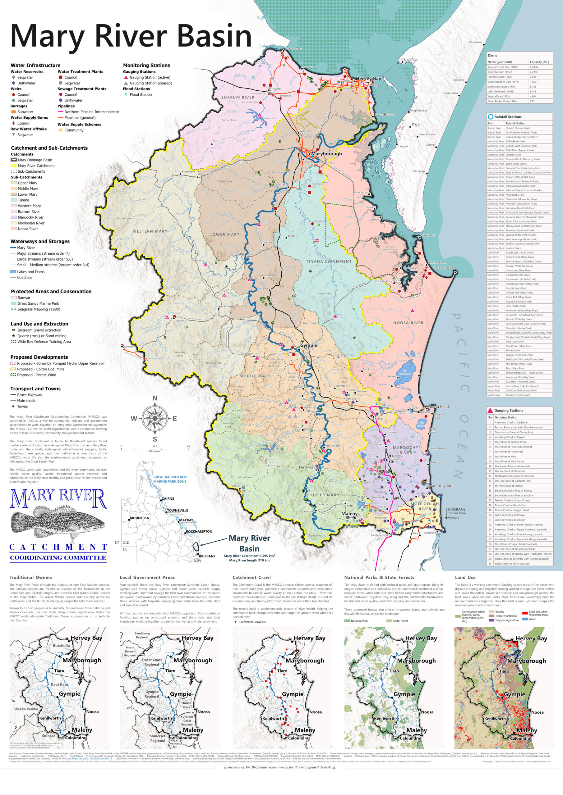
The Mary Basin map is now available on the MRCCC’s website to download. This highly detailed map features clickable links to gauging stations, allowing community members to monitor live river heights and access a wide range of essential catchment data.
Honoring the Legacy of Jim Buchanan
The map was the brainchild of the late former MRCCC Chairman and Life Member, Jim Buchanan. Jim envisioned a comprehensive visual tool that illustrates all natural waterways and man-made water infrastructure across the Mary Basin, extending beyond the Mary River catchment to include the Burrum River catchment and the Sunshine Coast.
Over his 20 years with the MRCCC, Jim consistently highlighted the challenges of interbasin water transfers used to supply growing urban populations—from Hervey Bay in the north down to Noosa and the Sunshine Coast. Understanding that water in the Mary River catchment is a finite resource, Jim was a tireless advocate for:
-
Water conservation & efficiency
-
Water recycling and reuse
-
Sustainable supply planning, including contributions to the MRCCC’s Water for the Future publication and strategies for water recycling and desalination.
Through Jim’s early advocacy and vision, the MRCCC is proud to share this resource with our broader community. We extend our sincere gratitude to everyone who helped bring Jim’s vision to life.